The Neogene stratigraphy of the glaciated European margin from Lofoten to Porcupine
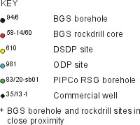
Preface ] Introduction ] Unified Stratigraphy ] Pre-Neogene Framework ] Miocene to Lower Pliocene ] Lower Pliocene To Holocene ] High-Resolution Stratigraphy ] Key Geoseismic Sections ]

Key Boreholes ] Figure 7 ] WP1 ] Figure 8 ] WP2 ] Figure 9 ] WP3 ] Figure 10 ] WP1 - Stratigraphic Range ] Figure 11 ] WP2 - Stratigraphic Range ] Figure 12 ] [ WP3 - Stratigraphic Range ] Figure 13 ] Event Stratigraphy ] Figure 14 ]

WP3 - ROCKALL_PORCUPINE

Stratigraphic-range chart for the Rockall–Porcupine region

The latest Palaeogene–Neogene stratigraphic-range chart for the Rockall–Porcupine region is based on 33 sample stations, consisting of 12 BGS boreholes, 9 BGS short rock cores, 6 commercial wells, 4 PIPCo RSG boreholes, 1 DSDP site and 1 ODP site. The sample stations are located on the map below. The distribution of the sample stations is widespread throughout the region, with information derived from the deep-water Rockall Trough and adjacent margins. Unfortunately, data from the Porcupine Basin are largely restricted to the pre-Neogene section.

The regional unconformity — reflector C10 — that separates megasequences RPa and RPb is fairly well constrained as an intra-early Pliocene event. This boundary has been especially well tested by ODP site 980/981 in the Rockall Trough, and BGS borehole 88/7,7A on the adjacent Hebrides Slope. The C10 reflector was penetrated at both these sites. Despite the contrasting depositional settings, the early Pliocene NN15 biozone has been recognised from sediments immediately overlying C10 at both sites, although the resolution in borehole 88/7,7A ranges from NN13–15. From inspection of the chart, this is consistent with information from other sites across the region that supports an erosional break between the NN13–16 biozones.

The basinal reflective zone, C20, that separates megasequences RPb and RPc is defined from the central and southern Rockall Trough, and is correlated with the NN4–5 biozones at DSDP site 610. An equivalent unconformity has been mapped with reasonable confidence from the Porcupine Basin. In both areas, this event marks a major change in sedimentation style. Older Miocene strata occur below C20 in the Rockall Trough, south of Rosemary Bank; however, the base Miocene (base Neogene) boundary cannot here be identified with any confidence. In contrast, a moderate-amplitude reflector that, in well 35/13-1, correlates with an early Miocene (NN1–2) hiatus marks the base of the Neogene in the Porcupine Basin. In order to adopt a uniform system of nomenclature in these adjacent basins, and to establish megasequence boundaries that could be mapped in both basins, it was felt appropriate to define the RPb/RPc megasequence boundary as the C20 reflector. The Palaeogene/Neogene boundary therefore lies within the RPc megasequence, except in the northern Rockall Trough, north of Rosemary Bank. Here the lower Miocene succession is largely absent and middle–upper Miocene sediments, e.g. well 164/25-2 and BGS borehole 88/7,7A, rest with angular unconformity on Oligocene strata.

Source of data

  1. Released well data / BP reports.

  2. Morton, A.C., Hitchen, K., Ritchie, J.D., Hine, N.M., Whitehouse, M. & Carter, S.G. 1995. Late Cretaceous basalts from Rosemary Bank, northern Rockall Trough. Journal of the Geological Society, London, 152, 947-952.

  3. Ruddiman, W.F., Kidd, R.B., Thomas, E. et al. 1987. Initial reports of the Deep Sea Drilling Project, 94. Washington (US Government Printing Office), 1261pp.


TOP

  1. Stevenson, A.G. 1990. British Geological Survey Shallow Drilling Programme 1990: Final Report. British Geological Survey Technical Report WB/90/47C.

  2. Stoker, M.S. 1989. British Geological Survey Shallow Drilling Programme 1988: Final Report. British Geological Survey Technical Report WB/89/19C.

  3. Stoker, M.S. & Hitchen, K. 1995. Rockall Continental Margin Project: Final Geological Report. British Geological Survey Technical Report WB/95/11C (5 volumes).

  4. Stoker, M.S., Leslie, A.B., Scott, W.D., Briden, J.C., Hine, N.M., Harland, R., Wilkinson, I.P., Evans, D. & Ardus, D.A. 1994. A record of late Cenozoic stratigraphy, sedimentation and climate change from the Hebrides Slope, NE Atlantic Ocean. Journal of the Geological Society, London, 151, 235-249.

  5. Flower, B.P. 1999. Planktonic foraminifera from the subpolar North Atlantic and Nordic Seas: sites 980-987 and 907. In: Raymo, M.E., Jansen, E., Blum, P & Herbert, T.D. (eds), Proceedings of the Ocean Drilling Program, Scientific Results, 162: College Station, Tx (Ocean Drilling Program), 19-34.

  6. Stoker, M.S. 1999. Irish Rockall Shallow Drilling 1999: Stratigraphic Summary. British Geological Survey Technical Report WB/99/22C.

  7. Released well data and biostratigraphic reports supplied by the Petroleum Affairs Division, Ireland (Dept. of Marine and Natural resources).

  8. Evans, D. 1986. British Geological Survey Shallow Drilling Programme 1985: Final Report. British Geological Survey Marine Report 86/20.

  9. Released well data and reports from Shell.

  10. Dobson, M.R., Haynes, J.R., Bannister, A.D., Levene, D.G., Petrie, H.S. & Woodbridge, R.A. 1991. Early Tertiary palaeoenvironments and sedimentation in the NE Main Porcupine Basin (well 35/13-1), offshore western Ireland evidence for global change in the Tertiary. Basin Research, 3, 99-117.

Distribution of sample sites. Bathymetric contours in metres


TOP

Key Boreholes ] Figure 7 ] WP1 ] Figure 8 ] WP2 ] Figure 9 ] WP3 ] Figure 10 ] WP1 - Stratigraphic Range ] Figure 11 ] WP2 - Stratigraphic Range ] Figure 12 ] [ WP3 - Stratigraphic Range ] Figure 13 ] Event Stratigraphy ] Figure 14 ]

Preface ] Introduction ] Unified Stratigraphy ] Pre-Neogene Framework ] Miocene to Lower Pliocene ] Lower Pliocene To Holocene ] High-Resolution Stratigraphy ] Key Geoseismic Sections ]


This page was Last updated 17 September 2002