WP1 - NORTH SEA FAN-VØRING
Stratigraphic-range chart for the North Sea Fan–Vøring region
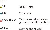
The latest Palaeogene–Neogene stratigraphic range chart for the North Sea Fan–Vøring region is based on 20 sample stations, consisting of 14 commercial wells, 2 geotechnical borings, 1 DSDP site and 3 ODP sites. The sample stations are located on the adjacent map. This indicates two main areas of sampling: the North Sea margin in the south, and the Vøring margin in the north. On the North Sea margin, the sample stations are clustered on the western flank of the Norwegian Channel, essentially testing the section preserved on the upper slope. A more extensive dataset exists on the Vøring margin where sample stations extend from the shelf onto the slope (Vøring Plateau).
The range chart confirms the existence of an intra-Pliocene unconformity that separates the Naust and Kai formations — the Base Naust Unconformity (BNU). This unconformity is clearly expressed in wells and boreholes from the shelf and upper slope, whereas on the Vøring Plateau sedimentation may have been more continuous. The biostratigraphic resolution of this event within the Pliocene is generally poor, which has led to a general 'mid-Pliocene' age assignment. However, well 6407/1-2 provides a tighter constraint on the BNU and implies a late early Pliocene age, about NN15, which is consistent with information from the Rockall–Porcupine region.
The range chart also indicates that the record of sedimentation associated with the Kai Formation is regionally variable. There is a significant early–mid-Miocene hiatus on the North Sea margin, whereas on the Vøring margin a more complete succession is preserved albeit punctuated by intra-Miocene unconformities. Significantly, the base of the Kai Formation is marked by a widespread unconformity — the Base Kai Unconformity (BKU) — across a large part of the region that separates it from the underlying Palaeogene strata of the Brygge Formation. The available data from both the North Sea and Vøring margins confirm that generally lower Miocene sediments overlie the BKU, although locally some ambiguity remains where sections appear to transgress the Oligocene–Miocene boundary. Moreover, at ODP site 643, the major hiatus appears to occur in upper Oligocene strata. Nevertheless, these data suggest that at the megasequence level of mapping a major break occurred at about the Palaeogene–Neogene boundary, not withstanding some degree of diachroneity. The fragmentary nature of the Miocene–lower Pliocene succession indicates that early Neogene sedimentation has been interrupted by several erosional events.
Source of data
-
Eidvin, T., Jansen, E., Rundberg, Y., Brekke, H. & Grogan, P. 2000. The upper Cainozoic of the Norwegian continental shelf correlated with the deep sea record of the Norwegian Sea and the North Atlantic.
Marine and Petroleum Geology, 17, 579-600.

TOP
-
Eidvin, T. & Riis, F. 1992. En biostratigrafisk og seismostratigrafisk analyse av tertiære sedimenter I nordlige deler av Norskerenna, med hovedvekt på Øvre Pliocene
vifteavsetninger. Norwegian Petroleum Directorate Contribution No. 32. 40 pp.
-
Eidvin, T. & Rundberg, Y. 2001. Late Cainozoic stratigraphy of the Tampen area (Snorre and Visund fields) in the northern North Sea, with emphasis on the chronology of early Neogene sands.
Norsk Geologisk Tidsskrift, 81, 119-160.
-
Eidvin, T., Brekke, H., Riis, F. & Renshaw, D.K. 1998. Cenozoic stratigraphy of the Norwegian Sea continental shelf, 64o -68o N.
Norsk Geologisk Tidsskrift, 78, 125-151.
-
Norwegian Petroleum Directorate. 1982.
Well Data Summary Sheets. Part 1, Volume 13, 233 pp.
-
Norwegian Petroleum Directorate. 1983.
Well Data Summary Sheets. Part 1, Volume 14, 183 pp.
-
Norwegian Petroleum Directorate. 1984.
Well Data Summary Sheets. Part 1, Volume 15, 381 pp.
-
Norwegian Petroleum Directorate. 1985.
Well Data Summary Sheets. Part 1, Volume 16, 372 pp.
-
Norwegian Petroleum Directorate. 1986.
Well Data Summary Sheets. Part 1, Volume 17, 322 pp.
-
Norwegian Petroleum Directorate. 1987.
Well Data Summary Sheets. Part 1, Volume 18, 260 pp.
-
Norwegian Petroleum Directorate. 1988.
Well Data Summary Sheets. Part 1, Volume 19, 216 pp.
-
Poole, D.A.R & Vorren T.O. 1993. Miocene to Quaternary paleoenvironments and uplift history on the mid Norwegian shelf.
Marine Geology, 115, 173-205.
-
Shipboard Scientific Party. 1987. Site 644: Norwegian Sea. In: Eldholm, O., Thiede, J., Taylor, E.
et al. (eds),
Initial Reports of the Ocean Drilling Program, 104: College Station, Tx (Ocean Drilling Program), 617-651.
-
Haflidason, H., Iversen, M., & Løvlie, R. 1998.
Møre and Vøring Basin geological investigation: lithological and chronological analyses of the geotechnical
borings. Report, University of Bergen, 50pp.
-
Eldholm, O., Thiede, J., Taylor, E.,
et al., 1987. Proceedings of the Ocean Drilling Program,
Scientific Results, 104: College Station, Tx (Ocean Drilling Program), 1141pp.
-
Eidvin, T., Koc, N., Smelror, M., & Jansen, E. 1998.
Biostratigraphical investigation of borehole 6704/12-GB1 from the Gjallar Ridge on the Vøring
Plateau. Report for the Seabed Project, OD-98-22, 27 pp.
-
Site Survey NOCS 6704/12-1S Gjallar Ridge. Final report,
results, 14pp
-
Talwani, M., Udintsev, G., et al. 1976.
Initial reports of the Deep Sea Drilling Project, 38. Washington (U.S. Government Printing Office), 1256pp.
-
Bjørklund, K.R. (1976). Radiolaria from the Norwegian Sea, Leg 38 of the Deep-Sea Drilling Project.
In: Talwani, M., Udintsev, G., et al. (eds), Initial reports of the Deep Sea Drilling
Project, 38. Washington (U.S. Government Printing Office), 1101-1128.
-
Bruns, P., Dullo, W.-C., Hay, W.W., Frank, M., & Kubik, P. 1998. Hiatuses on Vøring Plateau: sediment gaps or preservation artefacts?
Marine Geology, 145, 61-84.
TOP
TOP
|